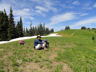
Whew, we don’t want a rematch.
The weather was once again beautiful, as it has been since we arrived. We had envisioned this one as a 1.5 mile, 1,500 ft. elevation trudge followed by some nice gentle ridge top walking to a small basecamp at the foot of Chowder Ridge.
Oftentimes, despite all the OCD planning, a hike just isn’t
what you envision. Once we reached the
ridge top, we looked ahead at more steep ups and downs. In reality, not much of this ridge top is
flat. Add in snowfields, increasing in both size and difficulty, and you have the makings of one tough hike.
Eventually we lost the supposed trail to Chowder Ridge. Since we had neither crampons, ice axes, nor
machetes, we could not advance further. At
one point, the trail completely disappeared on the side of a steep ridge. So, we started looking for a place to set up
camp with water nearby, and were not being very successful. After about an hour, we started heading off
the ridge to a place called Dead Horse Basin.
You could see potential sites about 400 ft. directly below us, but a
route to the basin was difficult to find.
We worked our way off-trail about 0.5 mile until we finally settled on a
beautiful meadow where about a dozen small rivulets joined together to form a
stream. It was also home to millions of
mosquitos, so for the first time ever, we donned our head nets.
It was nice getting into the tent at nightfall, and escaping
the blood suckers. The next morning the
swarms of mosquitos had eased, but it was only the end of their work
shift. They were immediately replaced by
yellow jackets and black flies. We
quickly ate, broke camp, and started picking a path back uphill to the ridge
top.
On the way back to the parking lot, we met a man
looking for his hat. He was originally
from Georgia, but had lived in Washington State for years. He wanted to talk about the Chattooga River
and the copperheads. According to this
fellow, you could not go into the Chattooga River Basin without a shotgun due
to these deadly creatures. Wow, I wonder
how Star and I have survived hiking the Chattooga for all these years. We also discovered from other hikers who stopped to talk that most people around here only understand where we're from if we mention Deliverance. I suppose they expect us to hike barefooted and in overalls, not to mention with the aforesaid shotguns.
The Skyline Divide is an incredible place with jaw dropping
scenery. We are glad we did this trek,
but it would have been much easier a few weeks later in the season without the
interminable snowfields and insects.
Star has about 100 mosquito bites to confirm this statement along with photo documentation I will not post.
I will, however, post these photos from the hike.
The "ridge top"
Our campsite
The world's largest smiley face!
Star modeling the latest in mosquito wear
Mt. Baker from our campsite at sundown
3,200 ft. elevation
8.2 miles on-trail
2 miles off-trail


No comments:
Post a Comment